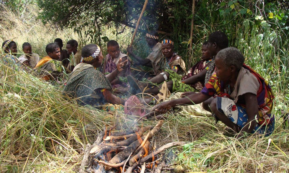
Godlisten wonder
Serengeti National Park's geology
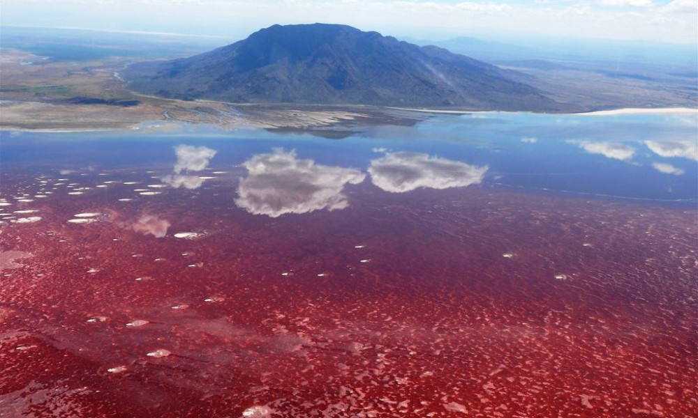
A high interior plateau makes up the Serengeti ecosystem's geology, creating picturesque scenes with amazing wildlife and scenery! From its highest points in the crater highlands, which are 3,636 meters above sea level, it descends to the Speke Gulf on Lake Victoria, which is 920 meters above sea level. The volcanic activity associated with plate tectonics in the Gregory Rift Valley produced the geology of the Serengeti highlands. The Ol Doinyo Lengai, which in local Maasai means "Mountain of God," is the only volcano on the site that is still active.
You will learn everything about the geology of Serengeti National Park in this article, including the meaning of the fabled word Kopje, the history of the soil and volcanic activity, mountains and hills, the Serengeti rivers, and more!
The granite is cracked as a result of the repeated cooling and heating caused by the African sun, and the wind also weathers the granite into fascinating shapes. The majority of kopjes are round or have round boulders on them.
Under the layers of volcanic ash and rocks that make up the soil of Serengeti National Park, you can find these ancient rocks. In the late Precambrian era, a massive bubble of liquid granite forced its way up from the molten rock beneath the Earth's crust and into the Tanganyika Shield.
Ancient crystalline rocks called kopjes, pronounced "kop-eez," protrude through the surfaces of more recent soils and rocks. The black clay soils that are impossible to drive over are created by these stones, and the granite gneiss (eyes) that form the light-colored sandy soils.
The most distinctive features of the Serengeti National Park's landscape are kopjes, also known as islands in a sea of grass. Therefore, when exploring the Serengeti's African plains, be sure to refer to them as such. In addition, many wildlife species, including lions, cheetahs, leopards, and others, call these ancient stones home. These animals can be seen relaxing on top of them to get a better view of their surroundings.
An interesting part of the geology of Serengeti National Park is its soil and volcanic history. To start, Africa is such an old continent. According to a source, it’s been called the "Mother of all Continents," as it is the oldest occupied continent—much older than Europe and North America.
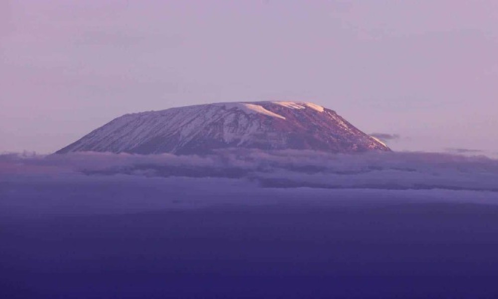
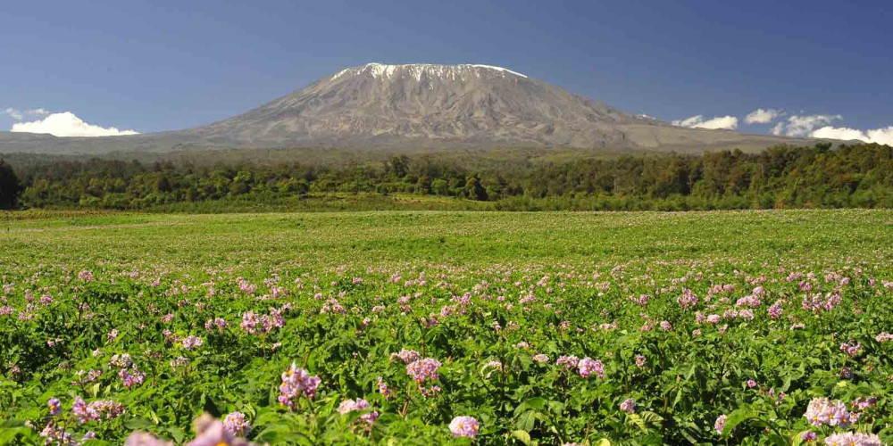
You can have a good view of this as you arrive at Kilimanjaro International Airport.
Furthermore, due to millions of years of weathering, the mountains have flattened and turned Africa into a string of endless rolling hills and Serengeti plains except for the East African rift system.
The East African Rift is the site wherein two tectonic plates move away from each other, resulting in cracks and creating both the Rift Valley and the volcanoes on each side of it. These volcanoes are relatively young and have erupted, covering the eastern plains of the Serengeti National Park with volcanic ash and other large particles.
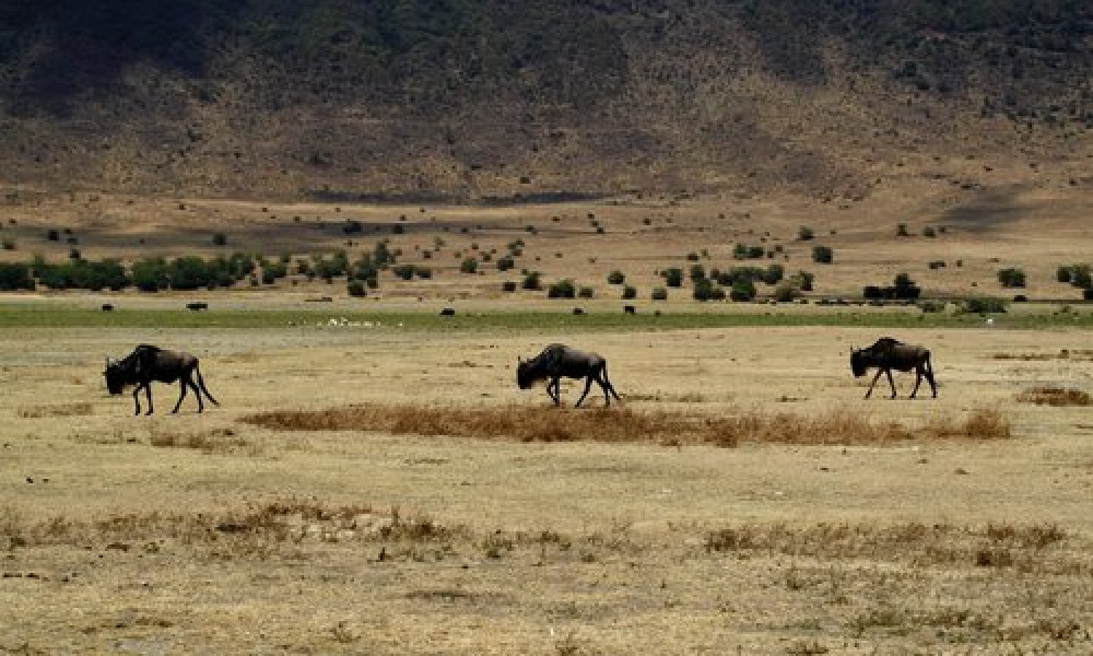
Mount Kilimanjaro, Mount Meru, and Mount Kenya are some of the best representatives of the rift volcanoes. Although the Ngorongoro crater seems like an extinct volcano, the Tanzanian geological survey stated that it never exploded, unlike its neighbors.
The volcanic ash that erupted in the Serengeti plains created nutrient-rich soils containing sodium, calcium, potassium, and varied salt types. The soil here is shallow, forming a calcareous hardpan known as caliche.
During the regional rainfall patterns, the salts drift off and wash down into the soil. The soil in the Serengeti National Park then gets deeper where the hardpan disappears into the woodlands and northern Tanzania plains due to more rain and less calcium.